
Parcel 11-1S-24-021R-0014-0000
Owners
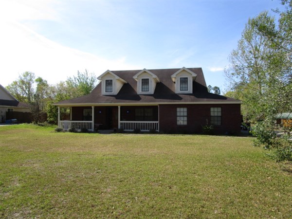
10271 FORD ROAD
BRYCEVILLE, FL 32009
Parcel Summary
| Situs Address | 10271 FORD RD |
|---|---|
| Use Code | 0100: SINGLE FAMILY |
| Tax District | 6: Drainage Dist |
| Acreage | 3.5900 |
| Section | 11 |
| Township | 1S |
| Range | 24 |
| Subdivision | CALICO RG PBK 6-52 |
| Exemptions | 01: Homestead (196.031(1)(a)) (100%) |
Short Legal
LOT 14IN OR 890/1254
CALICO RIDGE PB 6/52
Certified Values
| STANDARD | 2024 |
|---|---|
| Land Value | $71,800 |
| (+) Improved Value | $274,173 |
| (=) Market Value | $345,973 |
| (-) Agricultural Classification | $0 |
| (=) Assessed Value | $205,042 |
| (=) County Taxable Value | $155,042 |
Document/Transfer/Sales History
| Instrument / Official Record | Date | Q/U | V/I | Sale Price | Ownership |
|---|---|---|---|---|---|
| WD 0890/1254 | 1999-07-12 | Q | Improved | $156,100 | Grantor: SEDA CONSTRUCTION CO Grantee: MILBERGER JEFFREY C & JENNIE R |
| WD 0873/0956 | 1999-03-09 | U | Vacant | $26,600 | Grantor: SEMANIK INVESTMENT CORP Grantee: SEDA CONSTRUCTION CO |
| WD 0773/0854 | 1996-10-08 | U | Vacant | $230,000 | Grantor: MCCOLLOUGH THOMAS L TRUSTEE Grantee: SEMANIK INV CORP |
Buildings
Building # 1, Section # 1, 252060, RESIDENTIAL
| Heated Sq Ft | Year Built | Value |
|---|---|---|
| 2313 | 1999 | $261,433 |
Structural Elements
| Type | Description | Code | Details |
|---|---|---|---|
| EW | Exterior Wall | 20 | FACE BRICK |
| RS | Roof Structure | 08 | IRREGULAR |
| RC | Roof Cover | 03 | COMP SHNGL |
| IW | Interior Wall | 05 | DRYWALL |
| IF | Interior Flooring | 14 | CARPET |
| IF | Interior Flooring | 08 | SHT VINYL |
| AC | Air Conditioning | 03 | CENTRAL |
| HT | Heating Type | 04 | AIR DUCTED |
| BDR | Bedrooms | 3.00 | |
| BTH | Bathrooms | 2.00 | |
| FR | Frame | 02 | WOOD FRAME |
| STR | Stories | 1. | 1. |
Building # 2, Section # 1, 13686, RESIDENTIAL
| Heated Sq Ft | Year Built | Value |
|---|---|---|
| 700 | 2018 | $14,167 |
Extra Features
Land Lines
Personal Property
None
TRIM Notices
Property Record Cards
Disclaimer
The Nassau County Property Appraiser's Office makes every effort to produce the most accurate information possible. No warranties, expressed or implied, are provided for the data herein, its use or interpretation. The information contained herein is for ad valorem tax assessment purposes only. The Property Appraiser exercises strict auditing procedures to ensure validity of any transaction received and posted by this office but cannot be responsible for errors or omissions in the information received from external sources. Due to the elapsed time between transactions in the marketplace, and the time that those transactions are received from the public and/or other jurisdictions, some transactions will not be reflected.